Global Knowledge
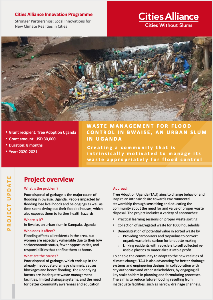
Waste Management for Flood Control in Bwaise, an Urban Slum in Uganda
Gender Equality
Climate Change and Resilience
17 Dec 2020

Download - English version | French version
The city of Kasangulu, Democratic Republic of the Congo (DRC), is the closest city to Kinshasa, a megalopolis with a population of 15 million. Kasangulu faces the outbidding of land transactions caused by growing land pressure on a population composed mostly of poor farmers whose property rights are not secured. The city is also struggling with a lack of data and unclear land relationships that create conflict.
A grant from Cities Alliance Innovation Programme has supported the pilot project Drones pour la clarification foncière et l’autonomisation des femmes (Drones for Land Clarification and the Empowerment of Women) to create a participatory process to formalise property and customary land rights for communities which are members of RADEKAS, a network of community-based development associations in Kasangulu.
The project introduces these major innovations:
This 2-page report highlights the key lessons learned and achievements of this 10-month project.